
Yellow weather warnings are in force across large parts of the UK as thunderstorms and torrential downpours threaten flash flooding, travel disruption, lightning and hail. A Met Office yellow warning for thunderstorms is in place from 3am until 10pm today (Wednesday, August 26), covering much of the Midlands and parts of northern, eastern and southern England, as well as eastern Wales. Forecasters warn some locations could receive 20-30mm of rain in just one hour, while the most intense storms could produce 40-50mm within a few hours. The sudden rainfall could lead to flash flooding, particularly following the prolonged dry spell which has left ground in some areas hard and less able to absorb water. Motorists have been warned of difficult driving conditions and the possibility of road closures, while frequent lightning and large hail could accompany the strongest thunderstorms. A band of heavy showers and thunderstorms is expected to move northwards during Wednesday morning, followed by brighter spells from the south. However, further scattered thunderstorms are forecast to develop during the afternoon. The nature of the storms means conditions could vary considerably over relatively short distances, with some communities experiencing torrential rain while places only a few miles away remain largely dry.
Further warning issued for Thursday
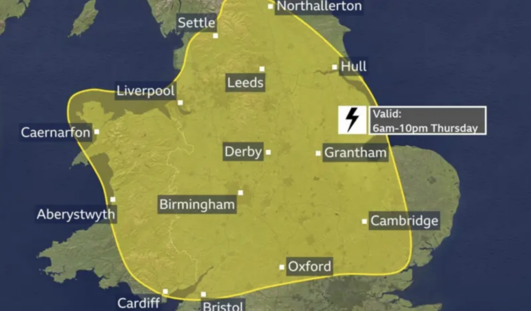
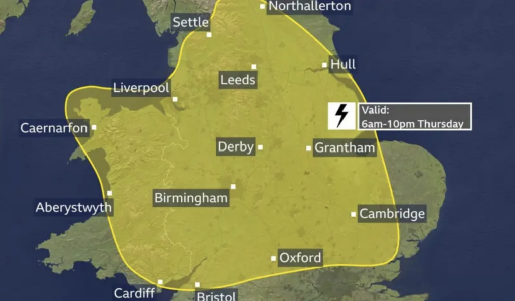
Another yellow thunderstorm warning has been issued for Thursday, August 27, running from 6am until 10pm and again affecting large areas of England and Wales. Rainfall totals of 20-30mm within three hours are possible, with some locations potentially receiving around 50mm over the same period. Forecasters say there is also a small chance that eastern-facing hills exposed to easterly winds could receive as much as 75mm over 12 hours, significantly increasing the risk of flooding. Hailstones measuring around 1-2cm could develop within the strongest storms alongside thunder and lightning. Northern Ireland is also expected to experience showers, although these are forecast to be less intense, while much of Scotland should remain dry with sunny spells before some showers move into the south-west. Some southern parts of the UK could receive more rain during the next few days than they have experienced for much of the summer. Brize Norton in Oxfordshire has recorded only 0.4mm of rain during August, while Kew Gardens has recorded just 1.8mm this month after receiving no rain at all during July. People travelling or planning outdoor activities are being advised to keep up to date with the latest forecasts and weather warnings as thunderstorms can develop quickly and their precise locations are difficult to predict.
Originally published by UKNIP.